Snorkeling
Best places to snorkel in December: wind, not warmth
Warm water does not make a snorkeling season — wind does. December to February brings peak trade winds, the best water temperatures and the most lost days.
We earn a commission on purchases made through links on this page, at no extra cost to you. It never affects which products we recommend.
On this page
Every guide to winter snorkeling answers the same question: where is the water still warm? It is the wrong question, and it is why people book a December reef trip and spend the week watching whitecaps from a balcony.
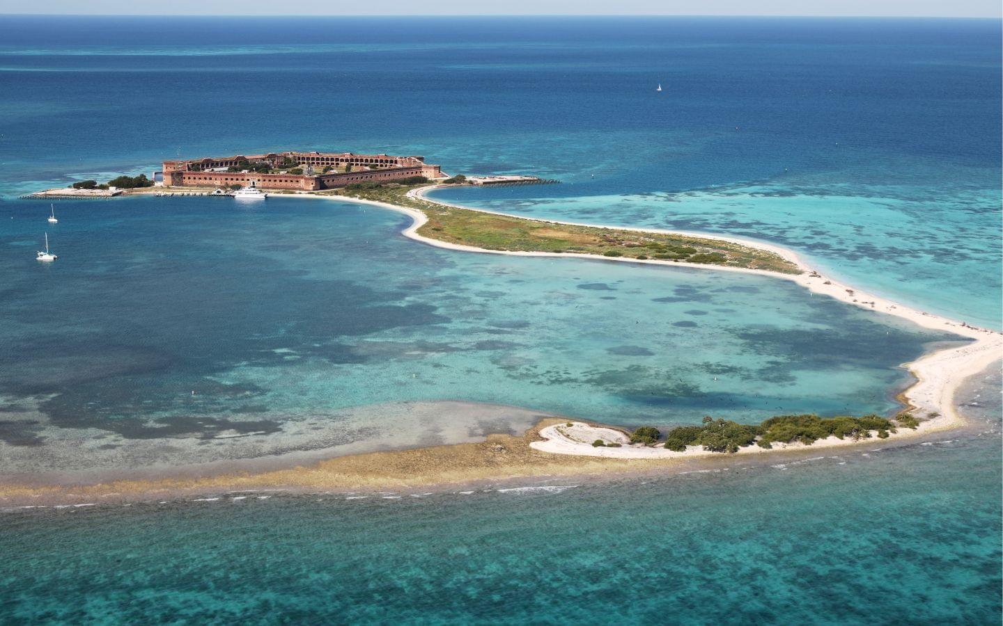
Warm water is easy to find in January. A calm morning is not. December through February is when the Caribbean trade winds reach their winter peak and when cold fronts start reaching Florida — so the months with the best water temperatures on paper are also the ones with the most blown-out days, the worst visibility and the most canceled boats. The National Park Service says it plainly about the Dry Tortugas: in winter, “consecutive days of 20+ knot winds and seas of greater than 5 feet are not uncommon,” and “for the visitor experience, this translates in to rough seas and poor visibility for snorkeling.”1 The same page describes summer as “little to no wind, and excellent visibility.”
So this page is organized around shelter rather than temperature: which coasts are in the lee in winter, which sites you can walk into when the boats stay tied up, and which trips to book on which day of your stay.
What is first-hand here, and what is sourced
I spent years in Key West working in the boat charter industry, putting people out over the reef. The Florida section is that experience: what a front does to a reef trip, what gets canceled and what merely gets ruined, and what I would book instead. I grew up in Puerto Rico and live at Jacksonville Beach now, where I surf year-round — so Atlantic winter fronts are something I watch rather than something I read about.
Nothing outside Florida and the Caribbean on this page is first-hand, and those sections are shorter for that reason. Every condition figure in them is footnoted to a meteorological service, a park agency or a peer-reviewed paper, and where I could not source something it is not here. So: Florida is reported, the Caribbean is judgement plus sourced numbers, and everything after that is research. You should not have to guess which is which.
Why wind matters more than water temperature
Three things happen at once in the northern winter, and all three run against the snorkeler.
The trades strengthen. Through the Windward Islands the prevailing wind swings northeast in autumn and winter, with “in general an increase in the force of these winds from mid-summer through the winter and a falling off in velocity in spring and early summer.”2 Further west the same seasonality shows up in the Caribbean low-level jet, the band of strong easterlies along about 15°N: a semi-annual cycle with a July maximum and a second maximum in the boreal winter, in February.3 The eastern Caribbean nickname for the reinforcement is the Christmas winds, and the mechanism is unglamorous — cold fronts push off North America, the Atlantic subtropical high strengthens behind them, the pressure gradient across the basin tightens.
Florida moves to the edge of the trade-wind belt. NOAA describes the Keys as “close to the northern boundary of the trade winds in winter but in the heart of this system in summer,” with the easterlies “occasionally interrupted by winter cold fronts.”4 The measurable consequence: winds of 22 knots or more blow about 7 to 12 percent of the time from October through March, and waves of 10 feet or more are reported 1 to 3 percent of the time from fall through spring.4 Mean wind speed at Key West runs 11.2 mph in January against 8.9 mph in July — the windiest month against the calmest.5
The fronts arrive. On the Gulf side, “from fall through spring, cold fronts occasionally reach these waters, generating strong, gusty winds that kick up rough seas.”6 Fronts are usually much modified by the time they get this far south, and NOAA is careful about that4 — but “modified” describes the air temperature, not the sea state.
None of this makes winter a bad time to snorkel. It makes it a season where where you go matters more than when, because a leeward coast, a sheltered bay or a house reef you can walk into turns a 20-knot morning from a cancellation into an inconvenience.
Winter conditions, region by region
Water temperatures are NOAA Coral Reef Watch’s climatological December–February monthly means for each region, which is a satellite reef-line figure and a historical baseline — recent winters run a little warmer.7 “Aim for” is the coast or aspect in the lee when the prevailing winter wind blows.
| Region | Dec–Feb water7 | Prevailing winter wind | Aim for | The winter risk |
|---|---|---|---|---|
| Florida Keys | 74–76 °F at the reef line; 69–72 °F inshore8 | E/NE, swinging N and NW behind fronts4 | Hawk Channel and the lee of the islands | Front-driven north wind: rough seas, poor visibility, cancellations |
| Eastern Caribbean (Windward Islands) | 79–81 °F | NE, strengthening through winter2 | West and southwest coasts | Reinforced trades; exposed east coasts are unusable |
| ABC islands (Aruba, Bonaire, Curaçao) | 78–80 °F | E, persistent and strong | Leeward west coasts — shore entry | Steady rather than gusty wind; the lee is genuinely calm |
| Quintana Roo (Cozumel, Riviera Maya) | 79–80 °F | E/SE trades, interrupted by nortes9 | Cozumel’s leeward west shore; cenotes inland | A norte shuts the boats for 1–2 days, sometimes 410 |
| Hawaii | 75–77 °F — cooler than the Caribbean | NE trades, strongest in winter and spring11 | South and west shores | North-facing shores carry large winter swell12 |
| Maldives | 82–83 °F | NE monsoon, January to March13 | The western, leeward side of the atoll14 | December is a monsoon transition month, and Malé’s second-wettest1315 |
| Philippines (central) | 79–81 °F | NE monsoon, amihan16 | Western and inner coasts | The Pacific-facing east coast has its rainfall maximum now17 |
| Raja Ampat (West Papua) | 83–84 °F | NW monsoon, November to April18 | Northern Raja Ampat and the Dampier Strait | Least of anywhere here — but “calm” means intermittent, not flat18 |
Florida and the Keys
This is the part I can write from the boat rather than from a table, so it is the longest section here.
What a cold front actually does to a reef trip
The Keys hold the only coral barrier reef in the continental United States, over 350 miles of it from the Dry Tortugas up to Martin County, much of that inside the Florida Keys National Marine Sanctuary.19 In summer, taking people out to it is close to a solved problem. In January it is a daily judgement call.
The pattern is consistent enough to plan around. A front approaches, the wind goes south to southwest and freshens — that day is often fine, sometimes beautiful, and it is the day nobody books because the forecast looks bad. The front passes and the wind clocks hard into the west and northwest,4 then settles into the north. That is the bad day, and it is rarely the wind speed that ruins it. A north wind pushes water off the shallow banks on the Gulf side and stirs the bottom, so the reef that was 60 feet of visibility on Tuesday is a green haze on Thursday. Then the wind swings back into the east, the sea lies down over two or three days, and the water clears from the bottom up.
Two things follow.
The trip that gets canceled is not the expensive problem. A cancellation gets rescheduled. The expensive problem is the trip that runs — because the boat can safely run — into water where you cannot see anything. An operator is making a seamanship decision, not a visibility promise, and those are different decisions. Given a captain who says visibility is poor and one who says it will be fine, believe the first. And ask what the wind has been doing for the last 48 hours rather than what it is doing now, because that is what the water is answering to.
Exposure is the whole variable. The Dry Tortugas sit about 70 miles west of Key West, reachable only by boat or seaplane,20 which makes them the most weather-exposed snorkeling in Florida and the first thing off the board in a north wind — the NPS tells campers to carry an extra day of food and water “in case of ferry cancellations.”21 The Dry Tortugas day trip is the one people came back raving about and it is still worth booking — but book it for the first usable day of your stay, not the last.
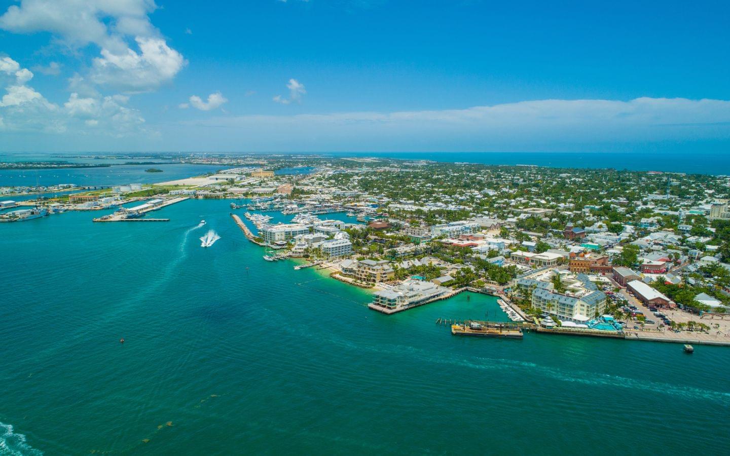
Inshore the arithmetic differs. A Key West reef snorkeling cruise on the closer patch reefs has the island to hide behind, and Hawk Channel — the water between the islands and the reef line — is sheltered from a north wind in a way the open Straits are not. Staying in Key Largo or the middle Keys puts you inside the sanctuary with a short run to the reef and a shore or bridge entry available when the boats are not going. Our guides to snorkeling in Key West and the Florida Keys have the individual sites.
The temperature, honestly
Two credible sources disagree here by about four degrees, and the disagreement is informative. NOAA’s satellite climatology for the Keys reef line gives 74 °F in January and 76 °F in December.7 Monroe County’s own tourism figures give 69 °F in January, 70 °F in February and 72 °F in December, against 87 °F in July.8 The satellite is reading the open reef; the tourism figure reflects shallower, nearshore water that a cold front cools far faster.
Plan against the lower number. Neither is dangerous and neither is comfortable. For twenty minutes most people are fine in a swimsuit; for a morning with two or three drops, a shorty or a neoprene vest changes the trip — and the reason is the interval on the boat rather than the swim, wet in a 15-knot breeze in February. Bring more than you think you need to put on afterwards.
The thing to book when the reef is off
Manatees cannot tolerate prolonged exposure to water below about 68 °F, and in winter they move into warm-water refuges to survive it.22 The springs feeding Kings Bay at Crystal River, on the Gulf coast north of Tampa, run at a constant 72 °F year-round,23 and the US Fish and Wildlife Service’s manatee sanctuaries there are in effect from 15 November to 31 March.24
Which inverts the whole problem. The cold front that ruins your reef trip is the same cold front that fills Crystal River. A manatee snorkeling tour in a spring run is not a consolation prize for bad weather — it only works in the cold, in shallow freshwater that no wind can blow out, and it gets better the worse the winter is. If a Florida winter trip has one weather-proof day in it, this is that day. Places to stay in Crystal River are unglamorous and close to the water, which is the right order of priorities for a 7 a.m. departure.
The Caribbean
Winter is the Caribbean’s dry season and the water stays around 79 to 81 °F through the Windward Islands — February is the coolest month of the year there and September the warmest.7 That is why every list puts the Caribbean first, and the lists are right about the water. What they leave out is that this is also the windiest part of the Caribbean year,2 and that the difference between a good week and a bad one is almost entirely which side of an island you are standing on.
The rule holds everywhere in the Lesser Antilles: in winter, go west. East coasts take the reinforced trades directly and are not snorkeling water in December; the west and southwest coasts are in the lee, and on many islands the difference across a few miles of land is total. On Barbados, that means the calm west coast, from Bridgetown north to Speightstown.
The ABC islands are the strongest winter recommendation in the region, for structural rather than scenic reasons. Aruba, Bonaire and Curaçao sit south of the hurricane belt, their reefs are on the leeward side, and much of the best snorkeling is shore entry — which is what matters in a windy month, because if you do not need a boat you cannot have your boat canceled. Bonaire is built around walking into the water from the road, so stays on the leeward coast — or on Curaçao — are the booking that buys you the week rather than one morning. Aruba’s reefs and wrecks are on the same protected side, and a leeward catamaran trip runs in conditions that would stop an east-coast operator.
North of there, the US Virgin Islands and the Cayman Islands give beach-entry snorkeling for families, with the same caveat about aspect. Dominica is the useful outlier — its snorkeling is all on the Caribbean-facing west coast, so a Champagne Reef and Scotts Head trip runs on a day when the island’s Atlantic side is unapproachable. Belize puts a barrier reef between you and the open sea, which is shelter of another kind. And Puerto Rico, where I grew up, follows the same rule: the south and west coasts are the sheltered ones, and the north coast in January is for surfers. More in our guide to the best snorkeling in the Caribbean.
Hawaii
Hawaii’s winter reputation is the north-shore surf, and it is deserved: the National Weather Service sets its High Surf Advisory threshold at 15 feet on north-facing shores against 10 feet on south-facing ones, and its warning threshold at 25 feet against 15 — an asymmetry that is itself an admission of where the problem is.12
The useful half is the other one. South shores “are usually calm in winter, shielded from northwesterly swells,” while northwest shores are “primarily exposed to large swells from storms in the northwest Pacific in winter.”11 Winter does not close Hawaii; it moves the snorkeling to the south and west, which is where the sheltered sites are anyway — Maui’s south and west shores, the Kona coast, Kauai’s reef-protected south, and Hanauma Bay on Oahu’s southeast rather than the north shore. Do bring something warm: at 75–77 °F, Hawaii’s winter water is cooler than the Caribbean’s.7
Winter also brings the humpbacks. NOAA’s Hawaiian Islands Humpback Whale National Marine Sanctuary states they “are generally seen in Hawaiʻi from November through April each year, with the peak season from January through March.”25 You cannot swim with them, and no legitimate operator will offer to.
Mexico’s Yucatán
The Yucatán’s winter dry season is why it fills up in January, and the Mesoamerican Reef off Cozumel and the Riviera Maya is genuinely world-class. The seasonal complication has a local name — nortes, the cold surges that come down across the Gulf and turn the wind hard into the north. They run from October through April, with the most intense events from December to March, and on the Riviera Maya they cluster in November to March at Cancún and February to April at Tulum.9 NOAA puts a duration on them: a norther “usually last[s] 1 to 2 days but can persist for 4.”10
But here is the part that gets misreported, and it matters more than the nortes do. On Mexico’s Caribbean coast, nortes account for only up to 28% of storm-wave events — wave conditions there “are largely influenced by the trade winds,” and Tulum in particular “is protected by Cozumel Island,” leaving it exposed mainly to easterly trade-driven swell.9 So the thing to plan around on this coast is the same reinforced easterly trade as the rest of the Caribbean, with the nortes as a punctuation.
Two consequences. Cozumel’s snorkeling is concentrated on its leeward western shore, so staying on Cozumel puts you on the sheltered side by default. And the cenotes — inland limestone sinkholes — are immune to wind entirely, which makes a cenote and turtle day out of Playa del Carmen the Yucatán’s Crystal River: the thing to do on the day the sea is unusable. Our guide to snorkeling in Mexico has the sites.
The Maldives, the Philippines and Raja Ampat
These are the long flights, and they need a caveat on everything above, because in monsoon Asia the winter wind runs the other way. The rule this page is built on is about wind direction and fetch, not about warmth — and where the winter wind comes off the land rather than off three thousand miles of ocean, winter is the good season. That is the case in two of these three.
The Maldives is where the travel shorthand needs correcting, and it matters if you are booking December. Its own meteorological service is precise: “The northeast monsoon (dry-season) extends from January to March. The month of December and April are considered as the monsoon transitional periods.”13 December is the changeover, not the settled season — and Malé’s long-term normals make it the second-wettest month of the year at 217 mm, against 38 mm in February.15 In the monsoon proper the western, leeward side of an atoll is the sheltered one; measured wave heights on the reef flat run about twice as high on the eastern, windward side.14 With one real catch: the northeast monsoon also drives productivity along those western edges, so the sheltered side and the clearest side are not the same side.14 Most of the best snorkeling in these 26 atolls26 is a house reef you wade into — the Bonaire logic again, which is why a house-reef stay matters more than any tour. Ask which way the reef faces before you book.
The Philippines is under the northeast monsoon, amihan, through the same months, bringing “cold and dry air,” northeasterly flow, and “rough sea conditions, especially over the seaboards of Luzon.”16 PAGASA’s national summary is a dry season from December to May, subdivided into “the cool dry season, from December to February” and the hot dry season after it.27 But that national average is contradicted by PAGASA’s own regional classification, and the contradiction is the whole point: the eastern seaboard is Climate Type II — “No dry season with a very pronounced maximum rain period from December to February.”17 Same wind, two faces. The northeasterly that gives Manila its cool dry season is what lands on Catanduanes, Samar and Surigao. Palawan, Coron and El Nido sit on the sheltered western side of that split, and Cebu, Moalboal and Apo Island are the reliable winter reefs. Siargao and Eastern Samar in January are not.
Raja Ampat is the one place here where winter is genuinely the better season, and it is worth saying so plainly. The northwest monsoon runs November to April and is “characterised by winds emanating from the northwest generating sporadic strong wind and swell,” while the southeast monsoon of May to October brings “strong and continuous southeast winds.”18 Note sporadic against continuous — the guides that call it “calm November to March” are overstating it. Winter there is intermittently rough rather than dependably flat, which is still much better than the alternative, and northern Raja Ampat and the Dampier Strait are the reliable end of it. It sits in the heart of the Coral Triangle,28 and if you are spending that much on flights, this is the half of the year to do it in. Our world snorkeling list ranks these long-haul reefs after the recent heat years.
The booking window
Five decisions follow from all of the above.
Book the exposed thing first, not last. Any offshore trip — the Dry Tortugas, an outer-reef boat, an atoll crossing — belongs in the first third of your stay, so a blown-out morning costs a reschedule rather than the trip. It is the cheapest insurance available and it costs nothing.
Keep one wind-proof day in reserve. A spring run, a cenote, a house reef, a sheltered bay you can walk into — booked and intended, not improvised on the morning.
Prefer shore access to boat access, all else equal. The whole argument, compressed: in 20 knots a boat trip has a binary outcome and a shore entry has a graded one.
Watch the last 48 hours, not the forecast. Visibility answers to what the wind has already done. A calm morning two days after a hard north wind is a lovely day with poor water; a breezy morning at the end of a settled week is often the better swim.
And if the dates are genuinely yours, think twice about December. For Florida and the Caribbean — most of this page — late spring and early summer are calmer. The exceptions are the two monsoon destinations, where winter is the better half of the year. Dubai’s Gulf of Oman coast is another place where winter is the good season, with February and March the best months. Otherwise, winter is for people whose dates are not their own, which is most of us, and which is why the rest of this page is about shelter.
Frequently asked questions
Frequently asked questions
Do I need a wetsuit to snorkel in December?
It depends far more on where you go than on the month. Caribbean water holds around 79 to 81 °F all winter and needs nothing. The Florida Keys run 69 to 72 °F inshore in December, January and February, which is cold enough that most people want a shorty or a neoprene vest for a full morning in the water — and cold enough that the wind chill between drops matters more than the water does. Hawaii is cooler than people expect too, at 75 to 77 °F. Our guide to what to wear snorkeling covers the thickness question properly.
What is the calmest month to snorkel in the Caribbean?
Not a winter one. Wind speeds through the Lesser Antilles increase from mid-summer through the winter and fall away in spring and early summer, so on wind alone May and June are the calm months and December through February are not. If you are locked into a winter trip, the fix is not a month — it is picking a leeward coast or a house reef you can walk into, so a windy morning costs you visibility rather than the whole day.
Will my snorkeling trip get canceled in winter?
It is a real risk in Florida and worth planning around. The National Park Service says of the Dry Tortugas that consecutive days of 20-knot-plus winds and seas above five feet are not uncommon in winter, and tells campers to carry an extra day of food and water in case the ferry is canceled. Book the exposed offshore trip early in your stay so there is room to move it, and have an inshore or freshwater option in reserve.
Where to go next
- Going to the Keys: snorkeling in Key West and snorkeling in the Florida Keys, for the individual sites
- Choosing a Caribbean island: the best snorkeling in the Caribbean
- Packing for cooler water: what to wear snorkeling, which covers the shorty-versus-vest question at 70 °F
References
Footnotes
-
“Weather.” Dry Tortugas National Park, National Park Service. nps.gov. ↩
-
Sailing Directions (Enroute) Caribbean Sea, Volume I, Pub. 147, Eighteenth Edition, 2025. National Geospatial-Intelligence Agency, Sector 9 (The Windward Islands and Barbados), ¶9.1. msi.nga.mil. ↩ ↩2 ↩3
-
Amador, Jorge A. “The Intra-Americas Sea Low-Level Jet.” Annals of the New York Academy of Sciences 1146, no. 1 (2008): 153–188. doi:10.1196/annals.1446.012. See also Whyte, F. S., M. A. Taylor, T. S. Stephenson and J. D. Campbell, “Features of the Caribbean low level jet,” International Journal of Climatology 28, no. 1 (2008): 119–128. doi:10.1002/joc.1510. ↩
-
United States Coast Pilot 4, Chapter 11 (“Miami to Key West”), Weather. NOAA Office of Coast Survey. nauticalcharts.noaa.gov. ↩ ↩2 ↩3 ↩4 ↩5
-
“Key West Wind Frequency Plots.” National Weather Service, Key West, mean monthly wind speed 1970–2016. weather.gov. ↩
-
United States Coast Pilot 5, Chapter 4, Weather. NOAA Office of Coast Survey. nauticalcharts.noaa.gov. ↩
-
“Averaged Monthly Mean” SST climatology from the NOAA Coral Reef Watch daily 5km Regional Virtual Station data files, converted from °C — stations Florida Keys, Windward Caribbean Islands, Aruba/Curaçao/Bonaire, Quintana Roo, Main Hawaiian Islands, Maldives, Central Philippines and West Papua. NOAA Coral Reef Watch. The climatology is a historical bleaching baseline rather than a modern 1991–2020 normal. coralreefwatch.noaa.gov. ↩ ↩2 ↩3 ↩4 ↩5
-
“Florida Keys Weather & Climate.” Monroe County Tourist Development Council. visitfloridakeys.com. ↩ ↩2
-
Ojeda, E., C. M. Appendini and E. T. Mendoza. “Storm-wave trends in Mexican waters of the Gulf of Mexico and Caribbean Sea.” Natural Hazards and Earth System Sciences 17 (2017): 1305–1317. doi:10.5194/nhess-17-1305-2017. nhess.copernicus.org. ↩ ↩2 ↩3
-
United States Coast Pilot 5, Chapter 3, Weather (“Extratropical cyclones”). NOAA Office of Coast Survey. nauticalcharts.noaa.gov. ↩ ↩2
-
“Surface Waves.” Ocean Atlas, Pacific Islands Ocean Observing System (PacIOOS), University of Hawaiʻi. pacioos.hawaii.edu. ↩ ↩2
-
“High Surf Advisory/Warning Information.” National Weather Service, Honolulu. weather.gov. ↩ ↩2
-
“Climate of Maldives.” Maldives Meteorological Service. meteorology.gov.mv. ↩ ↩2 ↩3
-
Kench, P. S., K. E. Parnell and R. W. Brander. “Monsoonally influenced circulation around coral reef islands and seasonal dynamics of reef island shorelines.” Marine Geology 266 (2009): 91–108. researchonline.jcu.edu.au. On northeast-monsoon productivity along the western atoll edges, see also Harris, J. L. and G. M. W. Stevens, “Environmental drivers of reef manta ray visitation patterns to key aggregation habitats in the Maldives,” PLoS ONE 16, no. 6 (2021): e0252470. doi:10.1371/journal.pone.0252470. ↩ ↩2 ↩3
-
Malé climatological normals (1981–2000), supplied by the Maldives Meteorological Service. WMO World Weather Information Service. worldweather.wmo.int. ↩ ↩2
-
“Onset of the Northeast Monsoon.” Philippine Atmospheric, Geophysical and Astronomical Services Administration (PAGASA), press release, 19 November 2024. pagasa.dost.gov.ph. ↩ ↩2
-
“Climate Map of the Philippines (1951–2010).” PAGASA / Department of Science and Technology, Climate Type II legend. pubfiles.pagasa.dost.gov.ph. ↩ ↩2
-
Setyawan, E., A. B. Sianipar, M. V. Erdmann, A. M. Fischer, J. A. Haddy, C. S. Beale, S. A. Lewis and R. Mambrasar. “Site fidelity and movement patterns of reef manta rays using passive acoustic telemetry in northern Raja Ampat, Indonesia.” Nature Conservation Research 3, no. 4 (2018): 17–31. doi:10.24189/ncr.2018.043, citing Mangubhai et al. 2012. ncr-journal.bear-land.org. ↩ ↩2 ↩3
-
“Coral Reefs.” Florida Keys National Marine Sanctuary, NOAA. floridakeys.noaa.gov. ↩
-
“Directions.” Dry Tortugas National Park, National Park Service. nps.gov. ↩
-
“Camping.” Dry Tortugas National Park, National Park Service. nps.gov. ↩
-
“Manatee Habitat.” Florida Fish and Wildlife Conservation Commission. myfwc.com. ↩
-
“Crystal River and Kings Bay.” Southwest Florida Water Management District. swfwmd.state.fl.us. ↩
-
“Activities.” Crystal River National Wildlife Refuge, US Fish and Wildlife Service. fws.gov. ↩
-
“About the Sanctuary.” Hawaiian Islands Humpback Whale National Marine Sanctuary, NOAA. hawaiihumpbackwhale.noaa.gov. ↩
-
Naseer, Abdulla. “Profile and Status of Coral Reefs in Maldives and Approaches to its Management.” Ministry of Fisheries and Agriculture. fao.org. ↩
-
“Climate of the Philippines.” PAGASA. pagasa.dost.gov.ph. ↩
-
“Coral Triangle.” World Wildlife Fund. worldwildlife.org. ↩

Nick Brisson — Co-founder, OutsiderView
Nick was born in Florida and grew up in Puerto Rico. He spent over ten years in Key West working in the boat charter industry, put four to five years into snorkeling and spearfishing the Florida Keys reef, and lives in Jacksonville Beach now, where he surfs year-round.