Snorkeling
Snorkeling in St Croix: the pier, the wall and Buck Island
St Croix's two best snorkels cost nothing but the walk in — Frederiksted Pier and Cane Bay — and its one boat trip worth paying for is Buck Island. The fees, the cruise-day rule, the reef as it stands, and the month to come.
We earn a commission on purchases made through links on this page, at no extra cost to you. It never affects which products we recommend.
On this page
St Croix sits forty miles south of the rest of the US Virgin Islands, on its own bank, with its own weather and its own rhythm.1 The distance is the point. The crowds, the cruise mobs and the boat-for-everything economics stay north with St Thomas — I put in over ten years running charter operations out of Key West, and I know exactly what that kind of market does to a day on the water. St Croix is the other thing: the USVI’s shore-entry island. Its two best everyday snorkels, Frederiksted Pier and Cane Bay, cost nothing but the walk in. It keeps one boat trip that is genuinely worth the money — Buck Island — and because this is United States soil, a US citizen needs no passport to get here.2
I grew up in Puerto Rico, one island group downwind of this coast, and this is the water I learned to read: trade wind out of the east, a calm lee on every west-facing shore, winter swell on the north. Read the island that way and the whole map organizes itself.
Where the sites are
St Croix runs 27 miles east to west,3 with Christiansted on the north-east coast, Frederiksted on the west end, and one road-trip of a north shore between them. Everything worth a mask sits on the north and west — the lee sides. The south coast is the windward side and stays off this page.
| Site | Where | Getting in | Cost | What it is for |
|---|---|---|---|---|
| Frederiksted Pier | West end, in town | Shore, beside the pier | Free | Seahorses and octopus in a piling forest |
| Rainbow Beach | West end, just north of town | Shore, sand | Free | The calm family default, with a bar |
| Cane Bay | North shore, mid-island | Shore, sand and rock | Free | The shallow shelf of a 3,200-foot wall |
| Salt River Bay | North shore, east of Cane Bay | Kayak, at night | From US$55 | Bioluminescence — not snorkeling |
| Isaac and Jack bays | Far east end, past Point Udall’s road | Foot trail, then shore | Free | A turtle-nesting preserve with nobody on it |
| Buck Island | 1.5 miles off the north-east coast | Concession boat from Christiansted | Free entry; US$95–135 boat | The lagoon, the elkhorn, the underwater trail |
Base yourself by what you want most. Christiansted is the harbor the Buck Island boats leave from and the livelier town; Frederiksted puts the pier, Rainbow and the west-end calm outside your door and is the right base for a snorkel-every-morning trip. The drive between them is about half an hour, so neither choice locks you out of anything.
One rule shapes the west end: Frederiksted is a cruise port, and when a ship is alongside, the pier and the water around it close to swimmers entirely.4 Check the cruise schedule before you promise anyone a pier morning, and hold Rainbow Beach as the ship-day fallback.
What the water is like now
Any guide that describes this island’s reefs from photographs taken before 2019 is describing a different island, so here are the numbers as they stand.
The disease came first. Stony coral tissue loss disease reached the USVI in January 2019 and has since progressed throughout the entire territory — it is present on every reef.5 Then the heat. Degree heating weeks are NOAA’s measure of accumulated thermal stress, and the 5 km satellite cell covering Buck Island and the north-east coast reads 16.30 in 2023, 21.06 in 2024 and 9.89 in 2025, with 123, 193 and 112 days above the alert threshold in those years.6 NOAA’s scale puts severe mortality in over half of corals above 16 and near-complete mortality above 20; the 2024 peak, on 10 November, cleared the worst line on the chart. The National Park Service says it straight about its own flagship: “coral diseases and hurricanes have significantly impacted Buck Island’s reef system.”7
Two things belong next to that. The 2026 number is zero — the same cell has accumulated no heat stress since 22 January, the first clean year since 2022.6 And what makes St Croix good was never wall-to-wall living coral. It is structure and animals: a piling forest, a drop-off, a protected lagoon, turtles in the seagrass, seahorses in the shadows. None of that bleaches. Set your expectations there and this island over-delivers.
Frederiksted Pier
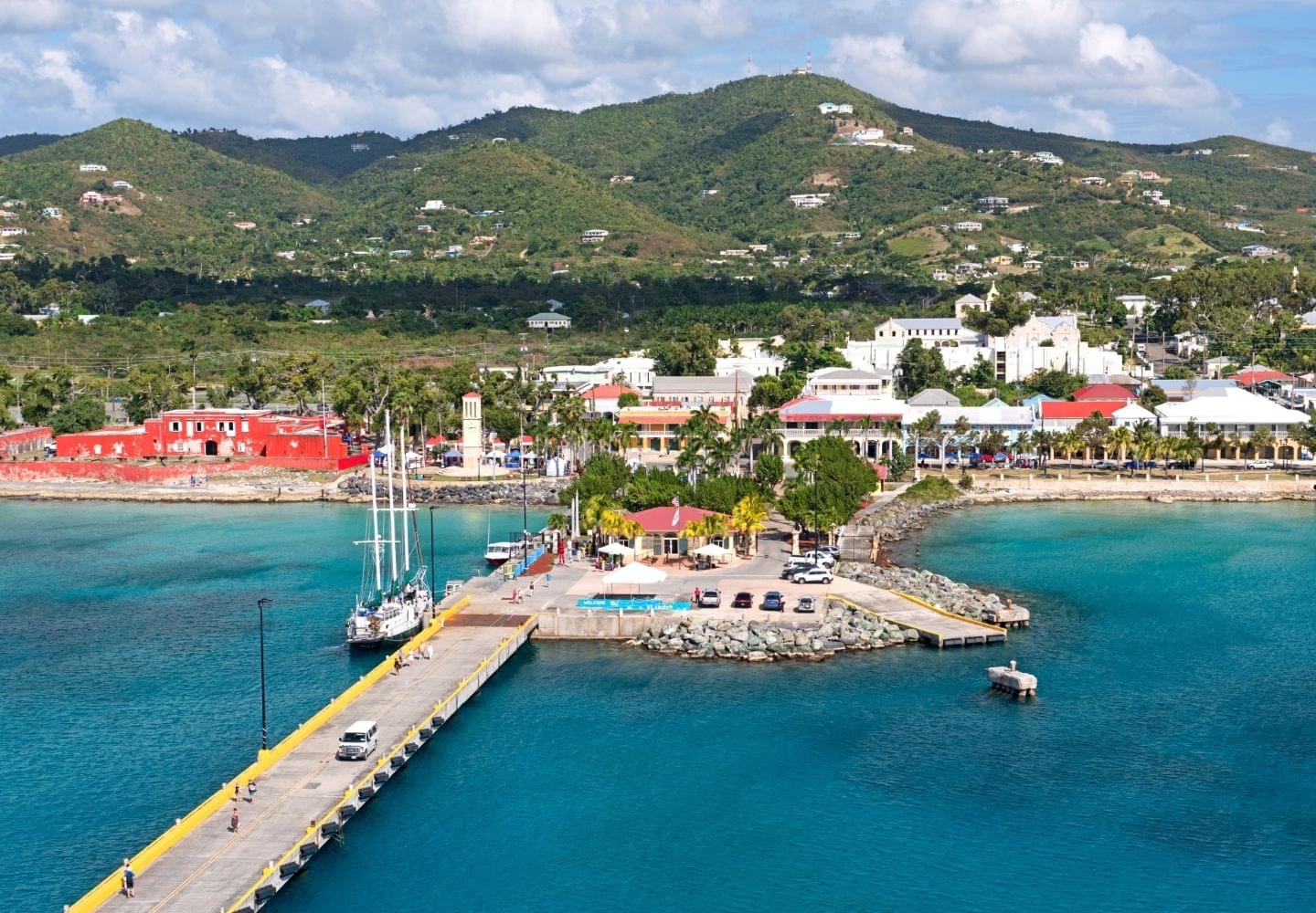
The single best free snorkel on St Croix is a working cruise pier, and I mean that as a compliment. The Ann E. Abramson Marine Facility runs 1,526 feet out from the Frederiksted waterfront, rebuilt after Hurricane Hugo tore up its predecessor in 1989 and carrying 29 feet of water on its north side and 36 on its south.8 Every one of those pilings has had three decades to grow a skin of sponge and coral, and the result is the closest thing the Caribbean has to a drive-through critter dive: seahorses, octopus, squid, frogfish, trumpetfish, barracuda and turtles all live in the structure, over a bottom that averages about 25 feet along the pier’s length and reaches 90 at the tip.4
For a snorkeler the depth numbers matter less than the entry: you can get in from the shore on either side of the pier and work the rocky base and the first rows of pilings in easy water.4 The west end is the island’s lee — this is the calm coast — which is why the pier is also where the dive shops run their night dives, when the octopus hunt and the tarpon feed.4 Snorkel it in the morning, before the afternoon breeze puts texture on the surface, and hang still: piling life shows itself to people who stop moving. A guided sea-turtle snorkel run by Sea Sports St. Croix meets at the pier entrance and is the right call for a first-timer or a family — ninety minutes, gear included — and a second operator runs a shorter turtle snorkel from King Street two blocks away.
The one rule, again, because it decides the day: ship in port means no snorkeling, no diving, no swimming around the pier, and no public access to it.4 That is port security, not etiquette. Plan pier mornings for no-ship days and give the day to the beaches when the schedule says otherwise.
Cane Bay
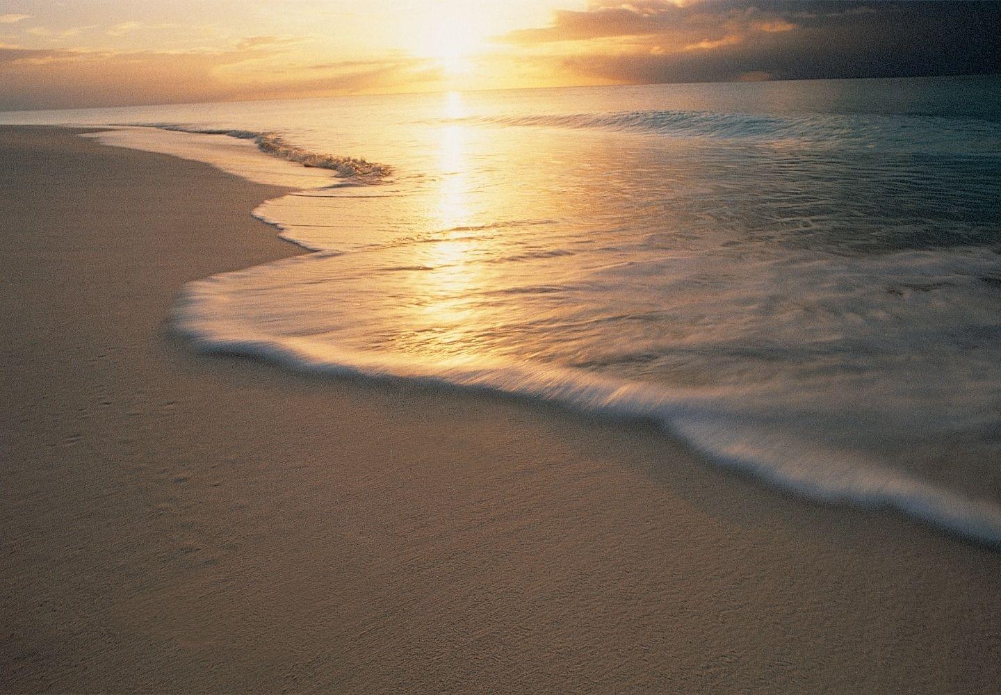
Cane Bay is the north shore’s famous mile: a sand-and-rock beach with a coral garden in the shallows and, a 200-plus-yard swim off the sand, the lip of a wall that falls from a 30–40 foot shelf to about 3,200 feet.9 The old habit of crediting that drop to the Puerto Rico Trench is wrong — the trench is on the far side of the archipelago — but the number itself needs no borrowed drama. It is the easiest place in US territory to float over a drop measured in thousands of feet, and the traffic goes both ways: divers work the wall, and the deep sends visitors up onto the shelf.
Be honest with yourself about which swim you are doing. The coral garden inside the bay is the snorkel — hard and soft corals and reef fish in comfortable depths, gear rentable on the beach.10 The buoy over the wall is a real open-water swim that earns its keep only on a flat day for a strong swimmer, and this shore takes swell and surge when winter systems pass to the north.9 When Cane Bay is white, don’t negotiate with it — drive twenty minutes and snorkel the west end, which will be calm. That is not a compromise; it is how you read an island with two coasts.
The beach itself has stayed easy: street parking, chair and water-sports rentals, and The Landing Beach Bar behind the sand.10 The operator map has rotated, which tells you how much has changed since the guides you may have read: Sweet Bottom Dive Center now faces the beach at Cane Bay,10 while the long-standing Cane Bay Dive Shop operates from 2 Strand Street in Frederiksted and runs its boat out of Salt River Marina.11
Buck Island Reef National Monument
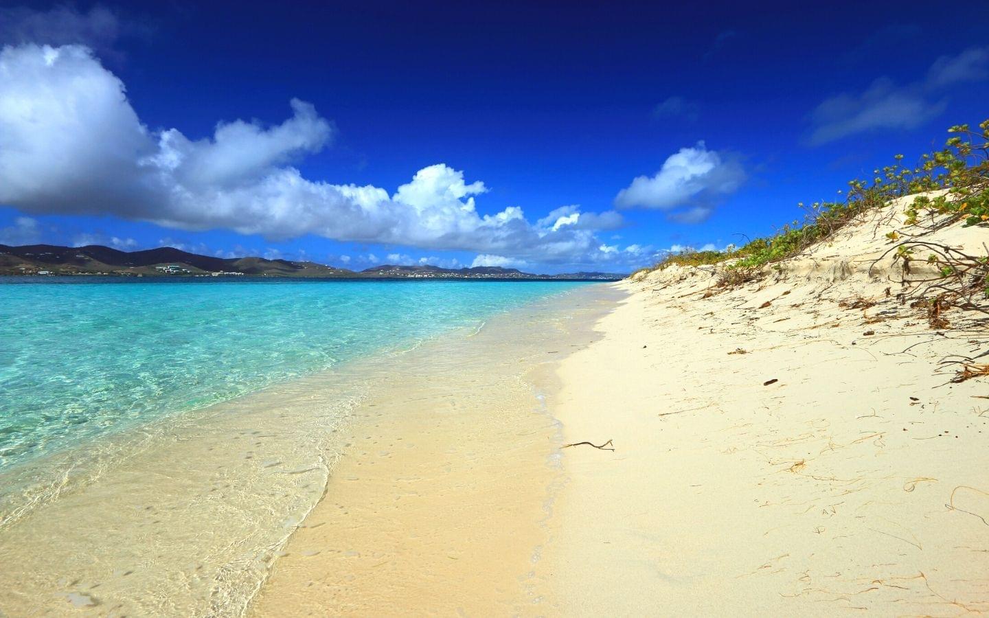
This is the one ticket to buy on St Croix, and it is bigger than almost every guide says. The “880-acre park” figure still circulating is the 1961 boundary; the monument was expanded by 18,135 acres in January 2001 and now protects more than 19,000 acres of water around a 176-acre island, a mile and a half off the north-east coast.12 An elkhorn barrier reef wraps two-thirds of the island, building a lagoon that seldom exceeds twelve feet deep — and inside it, at the east end, sits the underwater interpretive trail, reachable only by boat.713 The elkhorn here still push their mass to 30-foot heights,7 carrying the same disease-and-hurricane scars as the rest of the Caribbean, and the lagoon remains the most protected easy snorkel in the territory. Kennedy called this “one of the finest marine gardens in the Caribbean Sea” when he created the monument;12 the geometry that earned the line is intact.
Entry is free. The boat is the cost, and the boats are a National Park Service concession system, not a marketplace.1415 Five operators hold the contracts — Big Beard’s Adventure Tours, Caribbean Sea Adventures, Jolly Roger Charters, Llewellyn’s Charters, and Teroro II/Dragonfly — all departing from the Christiansted side, with the crossing running 40 to 90 minutes depending on whether you sail or motor.13 Book direct. Buck Island St Croix is not sold on Viator at all, and the “Buck Island” snorkel trips you will find there belong to Little Buck Island off St Thomas — a different island forty miles north, and an easy, expensive mistake for a reader moving fast.
The published prices, so you can plan: Big Beard’s runs the full day at US$135 — about six hours under sail on the catamaran Renegade, Turtle Beach plus the snorkel trail — and a half day at US$95 by power catamaran.15 Caribbean Sea Adventures runs a half day at US$95 (US$75 under-18), daily at 9:00 and 13:00, and a five-hour full day aboard Celebration at US$105 (US$85) on Monday, Wednesday, Friday and Saturday.16 Take the full day if this is your first time — it buys the beach hour and an unhurried trail — and take the 9:00 half day if you’re working around a cruise call. Morning over afternoon either way: the trades build through the day, and the lagoon is at its best before they do.
Three park rules worth knowing before you go. The monument is day-use only, 7:00 to 17:00, closed at night to protect nesting turtles, with no services on the island — carry water.12 It is a no-take zone: nothing comes home, not even a shell.17 And if you bring a private boat, anchoring is currently allowed without a permit only in the designated area off West Beach, under an NPS notice from January 2025 with updated procedures still pending — read the park’s alerts page before you drop anything.18
Rainbow Beach and the west end
Rainbow Beach, a few minutes north of Frederiksted, is the island’s calm-water default: west-facing, sandy, with restaurants and water-sports rental behind it and protected, easy water in front.19 This is where you send the nervous swimmer, the small kids and the sunset-with-a-drink contingent, and it is the standing answer whenever a ship day or a north swell takes your first choice away. Sea turtles graze the seagrass along this whole stretch between the pier and the beach4 — the guided snorkels above exist because the sightings are dependable.
South of the pier, the shoreline runs to Dorsch Beach and the Sand Castle stretch — quieter sand with the same lee-side calm, walkable from town along the waterfront.19 None of it is a reef; all of it is honest, easy water on the days that matter.
Isaac Bay and Jack Bay
The east end is the opposite proposition: no bar, no rental racks, no shade, and the best-earned swim on the island. Jack and Isaac Bay Preserve is 300 acres of Nature Conservancy land backing two white-sand bays below Point Udall — the easternmost point of the United States3 — with reef systems that hold elkhorn, staghorn and brain corals and somewhere around 400 species of fish.20 The beaches host St Croix’s largest nesting populations of green and hawksbill turtles, and the preserve is one of conservation’s quiet wins: since monitoring began in 2001, poaching has fallen from a third of nests to under one percent, and nesting green females have climbed from about eight to nearly three hundred.20
Getting in is a signed foot trail from the small parking bay on Route 82, just before the Point Udall monument.21 Carry everything — water especially, because the east end is the dry, cactus-scrub end of the island — and treat it as a morning expedition rather than a stop. The water is usually calm but takes chop and current when the trades are up,21 and out here you are alone with your judgement, which is the attraction and the responsibility in one. Confident snorkelers only; everyone else gets a better day at Buck Island, which is the same reef story with a boat crew attached.
Salt River Bay
Salt River Bay, on the north shore east of Cane Bay, is a national park unit — mangrove forest, an archaeological site that reaches back to the island’s first people, and submarine canyon walls offshore that pull divers from around the world.22 I’ll save you a hot walk: it is not a snorkeling destination. The water inside the bay is mangrove water, and the canyons are dive territory. Go anyway — at night. The bay is bioluminescent, and the way to see it is by clear-bottomed kayak: Sea Thru Kayaks VI runs two-hour night tours from Salt River Marina from US$55 with the largest see-through fleet on the island.23 Pair it with a Buck Island day and you have used this island’s water correctly at both ends of the clock.
When to go
Monthly water temperature off the north-east coast, from NOAA’s satellite record, averaged over the last three years:24
| Months | Water | Storms25 | Coral heat stress6 | Verdict |
|---|---|---|---|---|
| Feb – Apr | 80.7 – 81.5 °F, coolest and clearest | None | None | Go now |
| Dec – Jan | 81.3 – 82.6 °F | None | Residual, decaying | Next best; peak season pricing |
| May – Aug | 83.0 – 85.2 °F | Season opens 1 June | Building from July | Fine early, watch late summer |
| Sep – Oct | 86.1 °F | Peak, 10 September | Annual maximum | Worst on every axis at once |
| Nov | 84.5 °F | Season ends 30 November | Peaks early, then falls | Improving week by week |
February through April is the answer. The water is at its coolest — a rash guard, not neoprene; see what to wear snorkeling — the boats run full schedules, and both the hurricane season and the heat-stress season are far away. September and October stack the storm peak, the warmest water and the coral’s worst weeks on top of each other: the heat-stress maximum in this cell landed on 31 October 2023, 10 November 2024 and 6 November 2025.6 Hurricane Maria in September 2017 is the reason storm history hangs over every USVI plan;25 no repeat has hit this island since, and the 2026 season to early August has left the reef’s heat ledger clean.6
One more seasonal note the older guides don’t carry: the Caribbean’s sargassum influxes have grown into a March-to-August fixture, with 2026 running second only to 2025’s all-time record regionally.26 The weed lands on windward shores — St Croix’s south and east — and largely spares the lee. The pier, Rainbow and Cane Bay are exactly where you want to be, which is one more way this island’s geography does the work for you.
Getting there, what to book, where to stay
You fly into Henry E. Rohlsen Airport on St Croix itself,13 and from St Thomas there’s a seaplane and a daily ferry across the forty miles.1 Coming from the other direction, it is a short hop from San Juan — if you are stringing islands together, my Puerto Rico guide covers the water one group west, the Virgin Islands overview settles the St Thomas/St John/BVI question, and the Caribbean snorkeling guide ranks the region honestly.
Book Buck Island direct with Big Beard’s or Caribbean Sea Adventures — concession operators, published prices, no reseller layer. For the west end, the guided turtle snorkel at the pier (linked above) is the one worth pre-booking on a short visit, and the rest of the island’s bookable water — kayaks, sails, the lot — lives on Viator’s St Croix page. Bring your own mask whatever you book; rented masks are the most common reason a good day goes wrong, and our travel snorkel gear guide covers what packs small.
Sunscreen is a legal matter here, not a preference. The Virgin Islands banned the import, sale, use and possession of sunscreens containing oxybenzone, octinoxate or octocrylene from 30 March 2020, with fines of $1,000 for a first offense — and the legislature’s own findings named contamination at Rainbow Beach and Buck Island, two sites on this page, among its reasons.27 Buy mineral sunscreen before you fly, or solve it with a rash guard.
Where to stay follows the bases. In Frederiksted, The Fred is the adults-only boutique on Strand Street a short walk from the pier entry. On the Christiansted side, the Buccaneer Beach & Golf Resort puts you ten minutes from the Buck Island boats — and next to Shoys Beach, the east side’s easy swim: through the Buccaneer entry and the Estate Shoys guard gate, calm water over sand and seagrass with a small reef at its eastern end.28 And for the wall, The Waves at Cane Bay is the oceanfront boutique with the drop-off practically off its deck.
Frequently asked questions
Do you need a passport to snorkel in St Croix?
Not if you are a US citizen — St Croix is United States soil, so flying in from the mainland is a domestic trip. Carry proof of citizenship anyway, because you will want it for the flight home: the USVI tourism office recommends a passport as the best ID and says travelers without one should hold a raised-seal birth certificate plus government photo ID. That single fact is worth naming early, because it makes St Croix one of the few genuinely good Caribbean snorkeling islands a US family can reach on a driver's licence and a birth certificate.
How much does it cost to snorkel Buck Island?
Entry is free — the National Park Service charges nothing for Buck Island Reef National Monument. The boat is the cost, because you cannot walk there and the trips run as NPS concessions out of the Christiansted side. Big Beard's Adventure Tours runs a full day at US$135 an adult and a half day at US$95; Caribbean Sea Adventures runs a half day at US$95 (US$75 under-18) and a full day at US$105 (US$85). Book direct with a concessioner — Buck Island St Croix is not sold on Viator, and the "Buck Island" trips that are belong to a different Buck Island off St Thomas.
Can you snorkel Frederiksted Pier when a cruise ship is in port?
No. When a ship is alongside, the pier is closed to everyone but passengers and crew, and snorkeling, diving and swimming around it are prohibited — GoToStCroix carries the port rule in plain terms. Check the cruise schedule before you plan a pier morning. On a ship day, the west end still works: Rainbow Beach is a few minutes north, and Dorsch Beach and Sand Castle beach run south of town from the waterfront.
When is the best time to snorkel St Croix?
February through April. The water is at its coolest and clearest — about 80.7 °F in February and March by NOAA's satellite record for the cell off the north-east coast — the winter charter schedule is in full swing, and hurricane season is months away in both directions. September and October are the opposite on every axis: 86 °F water, the storm peak on 10 September, and the annual maximum of coral heat stress, which has landed between late October and mid-November in each of the last three years.
Do you need a boat to snorkel in St Croix?
Only once. St Croix is the shore-entry island of the US Virgin Islands: Frederiksted Pier, Rainbow Beach, Cane Bay, Shoys and the Isaac Bay trail are all walk-ins, and they cover seahorses, turtles, a coral garden and a 3,200-foot wall between them. The single boat worth paying for is Buck Island — the lagoon, the elkhorn barrier reef and the underwater trail sit a mile and a half offshore, and the concession boats out of Christiansted are the only way in unless you bring your own vessel.
Sources
Footnotes
-
“Frequently Asked Questions.” Christiansted National Historic Site, National Park Service, accessed 8 August 2026, nps.gov. St Croix forty miles south of St Thomas and St John; commuter flights, the seaplane and the daily St Thomas–St Croix ferry. ↩ ↩2
-
“Travel Tips.” United States Virgin Islands Department of Tourism, accessed 8 August 2026, visitusvi.com. No passport required of US citizens; a raised-seal birth certificate plus government photo ID as the alternative, and proof of citizenship needed on departure. ↩
-
“St. Croix.” United States Virgin Islands Department of Tourism, accessed 8 August 2026, visitusvi.com. The 27-mile island length and Point Udall as the easternmost point of the United States. ↩ ↩2
-
“Frederiksted Pier” and “St. Croix Dive Sites: The Frederiksted Pier.” GoToStCroix.com, accessed 8 August 2026, gotostcroix.com and gotostcroix.com/st-croix-dive-sites. The closure of pier and surrounding water to the public when a ship is in port; entry from anywhere along the pier or the surrounding shore; roughly 25 feet along its length and 90 at the tip; seahorses, octopus, squid, frogfish, trumpetfish, barracuda and turtles; night behavior. ↩ ↩2 ↩3 ↩4 ↩5 ↩6
-
“Virgin Islands Coral Disease.” VI Coral Disease Advisory Committee, accessed 8 August 2026, vicoraldisease.org. Stony coral tissue loss disease first observed in the USVI in January 2019 and now “progressed throughout the entire USVI and is present on every reef.” ↩
-
NOAA Coral Reef Watch 5 km Degree Heating Weeks for the cell at 17.775 N, 64.625 W (Buck Island and the north-east coast), daily series 1 January 2023 – 5 August 2026 retrieved 8 August 2026 via PacIOOS ERDDAP, coralreefwatch.noaa.gov. Annual peaks 16.30 (31 October 2023), 21.06 (10 November 2024) and 9.89 (6 November 2025); 123, 193 and 112 days at or above 4 DHW; zero accumulation since 22 January 2026; and the published mortality thresholds at 12, 16 and 20 DHW. ↩ ↩2 ↩3 ↩4 ↩5
-
“Natural Features & Ecosystems.” Buck Island Reef National Monument, National Park Service, accessed 8 August 2026, nps.gov. The elkhorn barrier reef around two-thirds of the island; lagoon waters that “seldom exceed 12-feet deep”; elkhorn pushing “their sheer mass to 30-foot heights”; and the statement that “coral diseases and hurricanes have significantly impacted Buck Island’s reef system.” ↩ ↩2 ↩3
-
“Ann E. Abramson Marine Facility.” Virgin Islands Port Authority, accessed 8 August 2026, viport.com. The 1,526-foot pier with 29-foot and 36-foot drafts; Hugo damage in 1989, reopening as a cruise facility in 1994, Marilyn damage in 1995, and the current pier built largely from the old pier’s material. ↩
-
Ogden, Jennie. “Dive the World Famous Cane Bay Wall.” GoToStCroix.com, accessed 8 August 2026, gotostcroix.com. The 200-plus-yard surface swim from the beach to the wall’s mooring buoy, the 30–40 foot shelf, the drop to about 3,200 feet off St Croix, and the swell and surge the bay takes at times. ↩ ↩2
-
“Cane Bay Beach.” GoToStCroix.com, accessed 8 August 2026, gotostcroix.com. Snorkel-gear rental to the coral garden of hard and soft corals; street parking; The Landing Beach Bar; chair and water-sports rentals; Sweet Bottom Dive Center across the road. ↩ ↩2 ↩3
-
Cane Bay Dive Shop, accessed 8 August 2026, canebayscuba.com. Current location at 2 Strand Street, Frederiksted, open seven days, with the dive boat operating from Salt River Marina. ↩
-
“Basic Information” and “History & Culture.” Buck Island Reef National Monument, National Park Service, accessed 8 August 2026, nps.gov. Hours 7:00 to 17:00, day use only, closed at night to protect nesting sea turtles; no visitor services on the island; a mile and a half offshore; over 19,000 acres of submerged and dry land around the 176-acre island; the monument expanded by 18,135 acres on 17 January 2001. ↩ ↩2 ↩3
-
“Directions.” Buck Island Reef National Monument, National Park Service, accessed 8 August 2026, nps.gov. Access “only by vessel, either private or concessionaire”; the five concession operators; the 40-to-90-minute crossing; the outer reef and underwater trail reachable only by boat; arrival via Henry E. Rohlsen Airport on St Croix. ↩ ↩2 ↩3
-
“Fees & Passes.” Buck Island Reef National Monument, National Park Service, accessed 8 August 2026, nps.gov. “There is no entry fee for Buck Island Reef National Monument.” ↩
-
Big Beard’s Adventure Tours, Christiansted, accessed 8 August 2026, bigbeards.com. Full day US$135 per adult, about six hours under sail aboard Renegade to Turtle Beach and the snorkel trail; half day US$95 by power catamaran. ↩ ↩2
-
“Half-Day Buck Island Snorkel” and “Celebration Epic Full Day Cruise.” Caribbean Sea Adventures, Christiansted, accessed 8 August 2026, caribbeanseaadventures.com. Half day US$95 adult, US$75 ages 18 and under, daily at 9:00 and 13:00, 3.5 hours, from the Christiansted Boardwalk; full day aboard Celebration US$105 adult, US$85 under-18, five hours, Monday, Wednesday, Friday and Saturday at 10:00. ↩
-
“Frequently Asked Questions.” Buck Island Reef National Monument, National Park Service, accessed 8 August 2026, nps.gov. The monument as a marine protected no-take zone: collection of plants, animals, shells or artifacts only under a research permit. ↩
-
“Alerts & Conditions.” Buck Island Reef National Monument, National Park Service, accessed 8 August 2026, nps.gov. The 17 January 2025 notice: anchoring allowed without a permit in the designated location on the west side of Buck Island, with updated permitting procedures to be announced. ↩
-
“Rainbow Beach” and “Dorsch Beach.” GoToStCroix.com, accessed 8 August 2026, gotostcroix.com and gotostcroix.com/discover/beaches/dorsch. Rainbow’s west-end position and calm water; Dorsch and the Sand Castle stretch just south of Frederiksted. ↩ ↩2
-
“Jack and Isaac Bay Preserve.” The Nature Conservancy, accessed 8 August 2026, nature.org. The 300-acre preserve; elkhorn, staghorn and brain corals and roughly 400 fish species; the island’s largest green and hawksbill nesting populations; poaching down from about a third of nests to under 1 percent and nesting green females up from about eight to nearly 300 since monitoring began. ↩ ↩2
-
“Jack’s Bay and Isaac’s Bay.” GoToStCroix.com, accessed 8 August 2026, gotostcroix.com. The signed trailhead at the Route 82 parking bay just before the Point Udall monument; no amenities; typically calm water with occasional chop and current. ↩ ↩2
-
Salt River Bay National Historical Park and Ecological Preserve, National Park Service, accessed 8 August 2026, nps.gov. Kayaking through the mangroves and the submarine canyon walls that draw divers. ↩
-
Sea Thru Kayaks VI, Salt River Marina, accessed 8 August 2026, seathrukayaksvi.com. Two-hour night bioluminescence tours from US$55 per person in transparent kayaks. ↩
-
NOAA Coral Reef Watch monthly 5 km sea surface temperature for the cell at 17.775 N, 64.625 W, August 2023 – July 2026 means by calendar month, retrieved 8 August 2026 via NOAA CoastWatch ERDDAP. February–March 80.7 °F as the annual minimum; September–October 86.1 °F as the maximum. ↩
-
“Tropical Cyclone Climatology.” NOAA National Hurricane Center, nhc.noaa.gov. The 1 June – 30 November season and the 10 September peak; Hurricane Maria’s September 2017 passage over St Croix in the TCR archive. ↩ ↩2
-
Sargassum Outlook Bulletin, July 2026, Optical Oceanography Laboratory, University of South Florida, optics.marine.usf.edu. Regional sargassum totals second only to the 2025 record, with continued inundation around the Caribbean islands. ↩
-
Act No. 8185, Bill No. 33-0043, Thirty-Third Legislature of the Virgin Islands, dc79r36mj3c9w.cloudfront.net. The ban on sale and distribution of sunscreens containing oxybenzone, octocrylene or octinoxate from 30 March 2020 (import from 30 September 2019), the use-and-possession prohibition, the $1,000/$2,000 fines, and the findings naming elevated concentrations at Rainbow Beach and Buck Island. ↩
-
“Shoys Beach.” GoToStCroix.com, accessed 8 August 2026, gotostcroix.com. Access through the Buccaneer property entry and the Estate Shoys guard gate; calm water over a sandy, grassy bottom with a small reef at the bay’s eastern end. ↩
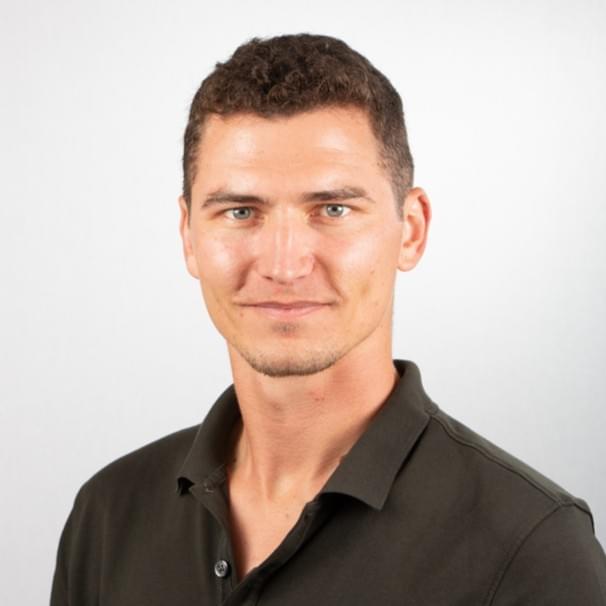
Nick Brisson — Co-founder, OutsiderView
Nick was born in Florida and grew up in Puerto Rico. He spent over ten years in Key West working in the boat charter industry, put four to five years into snorkeling and spearfishing the Florida Keys reef, and lives in Jacksonville Beach now, where he surfs year-round.